


Mankanahalli Ridge Point, Sakleshpur –Travel Guide
Mankanahalli Ridge Point near Sakleshpur has become an important tourist attraction in the Western Ghats in recent times, especially for travelers interested in nature, geography, monsoon landscapes, and offbeat destinations, following the release of the Kannada movie Mungaru Male in 2006. What makes this location particularly interesting is that it lies along a natural watershed where rainfall can flow towards two different river systems and, finally, two different seas.
Where is Ridge Point?
As the name suggests, it is located in the small hamlet of Mankanahalli, on the way to Bisle View Point. of Sakleshpur Taluk, along the route towards Bisle Ghat. It is roughly around 43 kilometres from Sakleshpur town by road, depending on the route taken.
The Ridge Point is located a few kilometres before the well known Bisle Ghat View Point. It is therefore convenient to cover both places in a single sightseeing trip.
How to visit Ridge Point from Sakleshpur
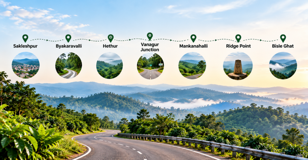
A commonly used route from Sakleshpur is:
Sakleshpur → Byakaravalli → Hethur → Vanagur Junction → Mankanahalli → Ridge Point → Bisle Ghat
The real time road conditions and accessibility can change, particularly during the monsoon, so travelers should check the current road situation before starting the journey from locals or the stay the y have opted of Home stays, Hotel or resort.
There are also small narrow village roads connecting the surrounding areas to Mankanahalli and the Bisle region. These roads can offer memorable views of coffee plantations, forests, hills, and Malnad western ghat countryside.
For navigation, searching for “Mankanahalli Ridge Point” on a mapmyindia or Google map application is advisable.
What Makes Ridge Point Special?
The main attraction here is not a large monument or a commercial tourist facility. The importance of Ridge Point comes from its geographical location.
It lies on a watershed or water divide ridge. Rain falling on opposite sides of the ridge can begin its journey in different directions.
This makes the Ridge Point an interesting example of how the Western Ghats influence the movement of water across the Indian peninsula.
Where Does the Rainwater Go?
One of the most Unique aspects of Ridge Point is the difference in drainage on both side of the ridge.
Rainwater flowing towards the western side eventually becomes part of river systems draining towards the Arabian Sea. In this region, the Kumaradhara and Netravathi river systems are associated with the western drainage network.
On the eastern side, water flows towards the Hemavathi and Cauvery river systems, which finally drain towards the Bay of Bengal.
Therefore, the simple geographical concept is:
Western slope → Arabian Sea
Eastern slope → Bay of Bengal
The Ridge Stone
A stone marker erected at the Ridge Point defines the important geographical divide. Local government website and travel related social media accounts generally mention it as the marker with surveying work carried out during the British period. However, the exact identity of the person who physically placed the stone and the precise year in which it was installed are not sufficiently established by authoritative historical records.
Some online social media accounts specifically associate the marker with Colin Mackenzie and the year 1802, , Colin Mackenzie extensively visited Karnataka. As a prominent military engineer for the East India Company and the first Surveyor General of India, he spent a significant portion of his career between 1796 and 1811 exploring, mapping, and documenting the history of the region. Following the defeat of Tipu Sultan, he led the comprehensive Mysore Survey.So it is believed to be he is behind the erection of this reidge point stone at mankanahalli.
What Can You See at Ridge Point?
Ridge Point is basically a nature and geography attraction. Visitors can witness:
– The historic ridge marker.
– The natural watershed.
– Western Ghats mountain scenery.
– Dense greenery and forest landscapes.
– Coffee plantations and Malnad countryside.
– Misty views during the monsoon.
– Rainwater flowing in different directions from the ridge.
– Photography opportunities.
– A peaceful, relatively less-commercialized environment.
The experience is particularly interesting during the rainy season when the landscape becomes lush and streams and small waterfalls appear in the surrounding region.
Which Gram Panchayat Does It Come Under?
Mankanahalli is a village in Sakleshpur Taluk of Hassan district. information Government Hassan district website associates Mankanahalli with Vanagur Gram Panchayat.
Distance from Sakleshpur
Ridge Point is approximately:
Sakleshpur → Ridge Point: 43 km
The actual distance can vary slightly depending on the starting point in Sakleshpur and the route selected.From Ridge Point, the Bisle Ghat View Point is only a few kilometres farther, making it practical and easy to visit both places during the same trip.
Tourist Attractions on the Way
If you are travelling from Sakleshpur towards Ridge Point and Bisle Ghat, several attractions and scenic locations can be combined depending on the available time.A popular sightseeing sequence is:
Sakleshpur → Manjarabad Fort → Hethur/Vanagur area → Mankanahalli Ridge Point → Bisle Ghat View Point
Why Should You Visit Ridge Point? Ridge Point is a must visit because it combines nature, geography, history, and the monsoon experience in one location.
It is not simply another viewpoint. Standing on the ridge and understanding that rainfall on opposite sides of the watershed begins flowing towards different river systems.
Leave a Reply